The options available depend on which region you choose.
Rectangle
The region is defined by maximum and minimum coordinate values. Clear at least one Unbounded check box and then type the coordinate range of interest.
Corridor
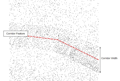
A Corridor Region is defined by a Terrain feature and a Corridor width. For example, a Corridor width or 100units will include anything less than 50units from the feature. Use the Select button to open the Select Features by Name dialog and then choose one or more features.
Points thinned by Corridor
Polygon
A Polygon region is defined by a terrain feature. Use the Select button to open the Select Features by Name dialog and then choose one or more features.
Exterior region (check box)
Select this check box to indicate that the region is outside of the boundary.