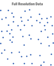
The Simplify Point Surface Data Dialog allows you to reduce the number of points used for TIN surface modelling. This is useful when LiDAR data has been over-sampled (some elevation points are very close to each other).
Note that break-line features are never modified.
Simplification
Method (drop list)
There are four methods of thinning (simplification). The first three use a Sample Grid; you can control the grid size with the Spacing field. Note that there is a limit to the number of Cells allowed; you will be warned if you exceed this limit. These methods produce more evenly spaced points than the import thinning options .
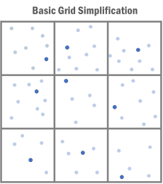
Basic Grid Simplification (fast)
One point per grid cell is retained. There is no interpolation; this does not produce a regular grid. The Calculate button can be used to determine the % reduction of points.
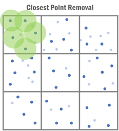
Closest Point Removal (slow)
This thinning method uses a Horizontal minimum distance in addition to the Sample Grid Spacing. Multiple points per grid cell can be retained if they are further apart than the minimum distance. Points close to other points (less than the minimum distance), will be discarded. This method is often slower than Basic Grid Simplification but it uses larger (and therefore fewer) grid cells to give similar resolution.
Closest Point Removal 3D (slow)
This is very similar to the option above except that an additional Vertical minimum distance must be specified. Points will be discarded if they are closer than the minimum distances in both horizontal and vertical directions to another point. If you set the minimum Vertical distance to be smaller than the Horizontal, the algorithm will tend to preserve more points in steeper areas such as cut banks and ditches.
Remove all points
This thinning method removes all points. It is useful for removing points that fall outside areas of interest (Excluded Regions).
Excluded Regions
This dialog allows you to preserve high resolution areas by excluding them from the thinning. Regions can be Rectangles, Polygons, Corridors.
Add (button)
Opens the Filtering Region dialog box so you can define a new region.
Modify (button)
Opens the Filtering Region dialog box so you can modify the selected region.
Remove (button)
Removes the selected region.
Point Counts
The Original number of points are those points that are candidates for thinning. They are included in the TIN model (3D, Elevation) but are not part of any break-lines. The Excluded Regions are ignored for this count.
The Calculate button will show you the number of points remaining after the current operation (Thinned and % Reduction). Calculate is only available for Basic Grid Simplification.