Stratum Layers
It is possible to define 3 stratum layers. Stratum Layers are used only in the Location Module.
Two methods of entering stratum layers are supported:
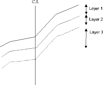
1) Centerline Depths
Depths at centerline define the stratum layers.
Figure 1. Centerline Depths
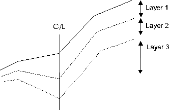
2) Extended Depths
In addition to centerline, depths at each side shot point define the stratum layers.
Figure 2. Extended Depths
To enter Centerline depths for 2 layers:
2) Enter a ground type for layers 1 and 2.
3) Enter a depth for layer 1 (the depth of the bottom layer is assumed to be infinite).
To enter Extended depths:
3) Enable Edit extended depths. Press OK to return to the Extended Side Shot Edit dialog.
4) Click on the Layers button to popup the Ground Types and Layers dialog.
5) Enter the ground types and centerline depths for the layers. Press OK to return to the Extended Side Shot Entry dialog.
6) The default depth at each side shot point will be the centerline depth. You may change these to suite your situation.