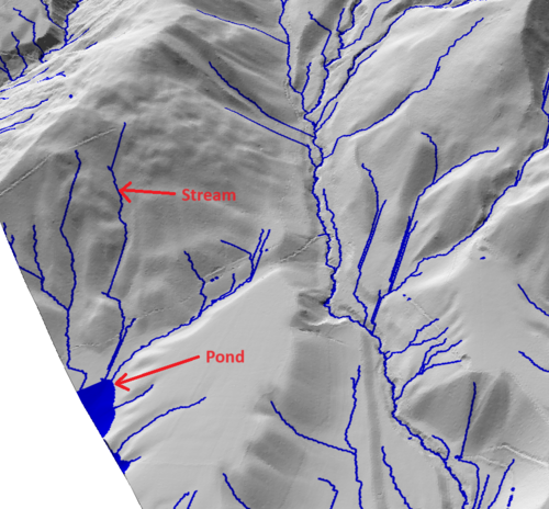
Ponds with an area smaller than this value will not be displayed. For the purposes of internal calculations, they will still be considered as flow outlets.
Stream drainage area
The drainage area threshold for a stream to be displayed. As this parameter increases, so does the number of streams.
If checked, depressions flattened by the depression fill will be displayed as pond features in the output. For the purposes of internal calculations, they continue to be represented as filled depressions.