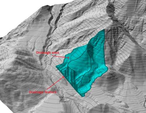
Given a point, a feature or a list of features, this tool calculates the regions that drain towards each selected point or feature. For each region, the geometric centroid and the most hydraulically remote flow paths may also be displayed.
Generated drainage areas with an area smaller than this value will be merged with the nearest drainage area.
Feature selection
Here, one or more target drain features can be selected. The tool will compute drainage areas towards all selected features simultaneously. For each selected feature, an independent set of drainage areas will be created, that is, the drainage areas of different features do not become merged. The feature corresponding to each drainage area is indicated in its name.
Drain only to current point
If this is checked, instead of draining towards a list of selected features, a drainage area will be computed towards the current point under the cursor.
Drain radius
If greater than zero, the outer boundary of the drain target feature(s) will be extended, in all directions, by this distance.