Export Regular Grid Options dialog
This option allows you to export regular grids (rasters) in dem, tif and terx formats. For more information about regular, see Regular Grid. For more about exporting file formats, see the Export Setup dialog help page.
Grid Layout
Origin
Grid origin point X and Y coordinate. These fields are disabled if Set from terrain extents is checked.
Width
Width of the grid in X and Y directions. These fields are disabled if Set from terrain extents is checked.
Cell Size
Total numnber of grid cells.
Size
This calculated value shows the required number of the grid cells in X and Y.
Z Values
Operation
This combobox allows you to determine how the Z values are calculated. The following options are avaliable:
Constant - Z is set to constant elevation.
Surface A - Z is determined from the Surface A TIN model.
Difference (A-B) - Z is set to the difference between Surface A TIN model and Surface B TIN model. The value is undefined if either A or B doesn't exist.
Minimum (A,B) - Z is set to the minimum of A TIN model and B TIN model. If either A or B doesn't exist the result is determined to the Apply when combobox.
Maximum (A,B) - Z is set to the maximum of A TIN model and B TIN model. If either A or B doesn't exist the result is determined to the Apply when combobox.
Merge (A->B) - Z is set to A TIN model wherever it exists.
Merge (B->A) - Z is set to B TIN model wherever it exists.
Note: If exporting to DEM or TIF, the current Surface A TIN elevation option only is avaliable.
Value
The value associated with the Constant operation.
Fill Depth
The option will only be available if Watershed Features operation is selected. This depression Fill Depth parameter is used to smooth the surface by filling minor depressions(prior to calculating the watershed features. (see Create Watershed Features).
Apply when
This combobox allows you to control the output when either Surface A or B don't exist.
A
Is set to the current terrain file.
B
Defines terrain file B. This field is not for some Operations.
Save undefined values
If selected, the entire grid is saved.
Open file in a new window after it has been saved.
If selected, the file is opened in a new instance of Terrain.
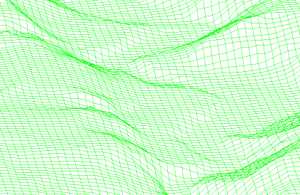
Wireframe lattice format.
If selected, the regular grid is saved in a connected linear features (see example below).
NOTE: This option is only available if TERX format is selected and the Operation is Surface A.