RoadEng Civil Engineer: Easier, faster & more affordable alternative to Civil 3D, built for rural infrastructure projects.

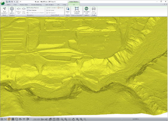
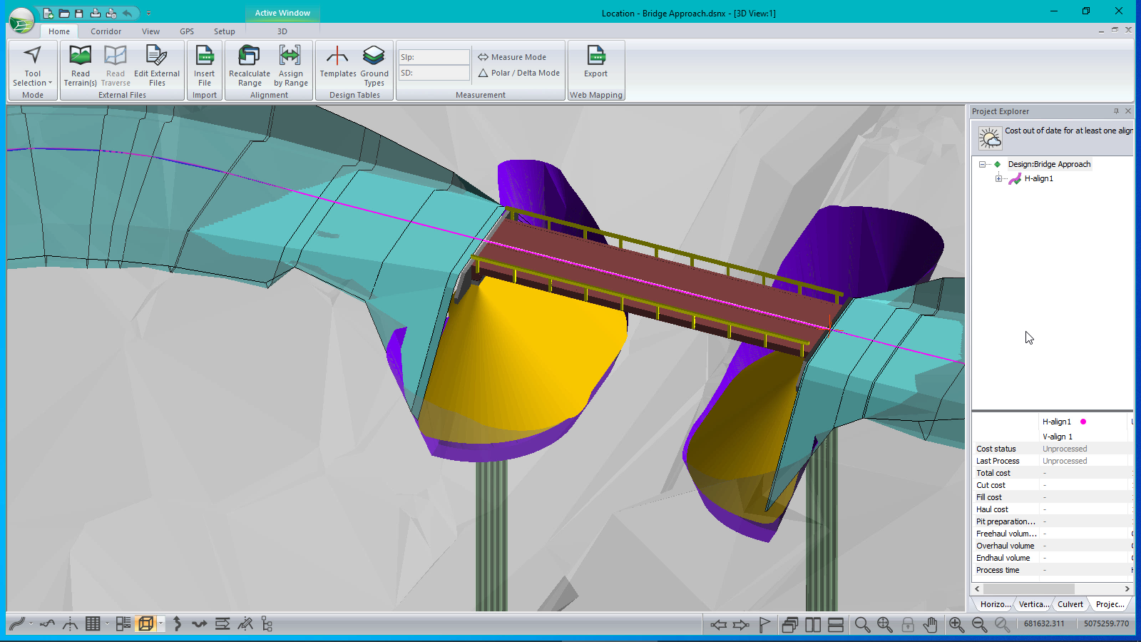
Faster, lighter, easier and specialized for the design of rural infrastructure, RoadEng significantly speeds up the corridor design process. Built from the ground up to work with surfaces, cross-sections, and alignments, RoadEng handles larger data sets in ways other civil design software cannot.

No additional CAD software required. You don’t need to struggle with complicated and expensive CAD software. No need to learn and re-learn complicated software for complex highway interchanges and other things you don’t do.
 

RoadEng Easy Road Design.jpg


Why use RoadEng?

  • Easy to Use

    Quick learning curve makes learning the software and training staff fast and easy. 90% of users do not require formal training.

  • Design start to finish

    And everything in between... Enter survey data, create horizontal & vertical alignments, calculate earthwork quantities, create output sheets.

  • Focus on engineering, not drafting

    Not just for CAD specialists. Our suite of products has been designed for busy engineers.

  • Real-time interactivity

    See the data. Change the design. No waiting around. RoadEngĀ® works with you to build accurate models, design better alignments, and save earthwork costs.

  • Easily output & share

    Create .pdf output sheets. Share DWG, DGN, and LandXML files with other programs. Our civil design package works alone or can integrate into other engineering programs.

Try RoadEng for 3 Weeks (FREE!)

RoadEng Features & Functions

Interactive Rural Road & Infrastructure Design

Geometric corridor design in a simple and intuitive user interface. Visualize your road design in 3D, plan, profile and section views simultaneously. Make a change to the project, dynamically watch all of the windows update. 

Interactive Design Windows.png

Fast Terrain Modelling

Quickly create digital terrain models (TIN) from almost any topo data, including large point sets (like UAV or LiDAR data) with over 10,000,000 points. Create contours, labels, and customize your display with slope vectors, and color shading for slope, aspect, and elevation. Selectively thin and control your survey data.

BigMIne3D.png

Dynamic Cross-Section & Template Control

RoadEng’s flexible template editor allows you to assemble typical sections using a library of customizable components. Account for ditches, pavement, sub-base materials, varying lane widths, cut slopes, variable height fill slopes, curbs, sidewalks etc.

Visualize the template in typical sections (or at a specific station) prior to implementing in your design.

Template Editor.png

Earthwork Volumes & Costs As You Design

Get your detailed earthwork and material volumes, as well as the sub-grade construction costs. With earthwork costing data as you design, you can adjust your design based on cost. Compare costs for design alternatives. Know preliminary construction costs before you build.

Culvert Design

RoadEng includes two primary methods for the design of culverts, cross drains and fish passages. Add simple culverts using the culvert editor panel in RoadEng's Location Module. Culverts can also be designed in more detail using multiple alignment functionality.

Output & Sharing

Easily share and showcase your design with Multi-Plot Report Builder. Print out plan, profile, and cross-section data as one document. Simplify your presentation of deliverables with single document control.

Output sheets interactively update with your design. 

Easily output and share with other programs. RoadEng and Softree Optimal both work alone, or it can integrate into other CAD or GIS-based engineering systems. Easy export to machine control through LandXML.

Output Sheets.png

More than just Linear Infrastructure

A variety of simple, but powerful features are available for site design and grading. Create virtually anything in 3D: bridge sites, terracing, pipes, surfaces, channels, ditches, pads or sub-surface zones.

RoadEng Civil Engineer

RoadEng Civil Engineer

  • Terrain Module  - used for 3D Terrain modelling and site design. 
  • Location Module - specialized module for corridor design and projects.


REQUEST A QUOTE

Free Trial

RoadEng Forest Engineer

RoadEng Civil Engineer + Softree Optimal

  • Terrain Module - 3D Terrain Modelling and design. Also contains function group for Cable Harvest planning.
  • Location Module - specialized module for corridor design and projects.
  • Softree Optimal - add-on in the Location module to optimize the earthworks (profile) for the alignment. Minimizes subgrade construction costs.

REQUEST A QUOTE

Free Trial

“I WOULD DEFINITELY RECOMMEND ROADENG TO ANYONE LOOKING FOR A USER-FRIENDLY ROAD DESIGN PACKAGE.

In Mahnomen County, our problem has been finding a road design software package that is simple enough for our technicians to learn and retain after a season of being in the field, but that is also powerful enough to do the things that we need to accomplish in our road designs.

Our Engineering Technicians find it easy to learn and use, and the quantities generated by the program have been very accurate. The other thing I have been very pleased with is the technical support for the program. The group at Softree has been very quick to answer any of our questions and have been great to work with. "

-- Jonathan Large, P.E., County Engineer, Mahnomen County, Minnesota MN

Read More Testimonials

System Requirements

Windows 7, 8, 8.1, 10 or 11 Operating System
2 GB system RAM (4 GB recommended)
Minimum 800 x 600 resolution (more recommended)
Processor or motherboard built-in video is adequate
1 GB disk space

Technical Brochures

Additional Documents

Links to Version Update Information

RoadEng Version 10 Features & Improvements

RoadEng Version 11 Features & Improvements

Try RoadEng for FREE!

Free Trial for 3 weeks. Get started today!