CLIENT: ARATU FORESTS | LOCATION Gisborne, New Zealand | SOFTWARE: RoadEng
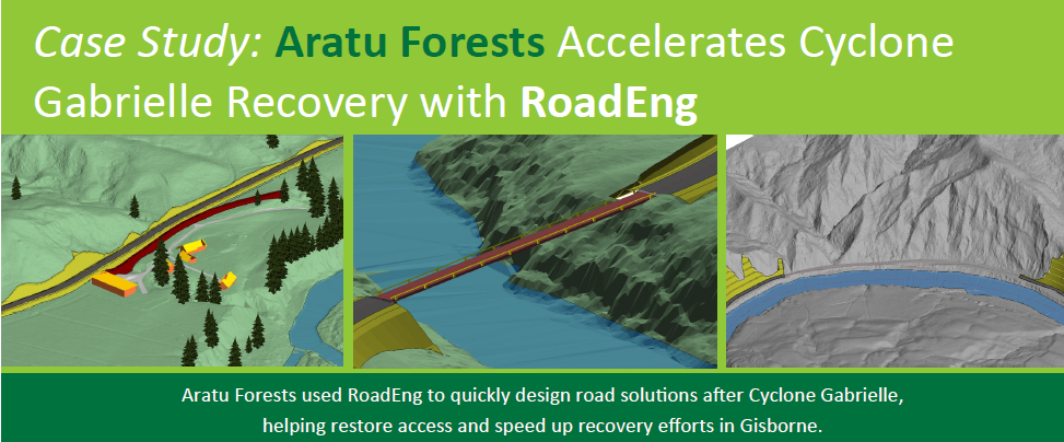
Aratu Forests used RoadEng to quickly design road solutions after Cyclone Gabrielle,
helping restore access and speed up recovery efforts in Gisborne.
In February 2023, Cyclone Gabrielle caused catastrophic damage to New Zealand s Tairāwhiti region. The region s infrastructure was devastated: all major roads were impassable, there were more than 3,000 faults across the road network, and 43 bridges were damaged (8 of which were destroyed).
Aratu Forests’ Role in the Recovery:
Aratu Forests, one of the largest forestry companies in the region, suspended its operations to support the recovery efforts. Aratu Forests partnered with a large civil engineering contractor, providing design work to assist in restoring vital road access to remote areas as quickly as possible. Central to their success was their use of RoadEng, allowing them to rapidly design and deliver solutions for damaged infrastructure.
Leveraging RoadEng for Rapid Response:
Aratu Forests leveraged existing LiDAR data, combining it with drone drone-based photogrammetry to create accurate 3D terrain models of the damaged infrastructure. Using RoadEng, they were able to quickly convert this data into actionable road designs, modelling fixes & alternative routes. Depending on the complexity of the task, Aratu Forests was often able to provide initial designs within 24 hours hours—a fraction of the time required by more traditional design tools. With RoadEng, the team quickly modelled routes, assessed options, and estimated materials. RoadEng s clear visuals helped stakeholders easily understand the designs, speeding up approvals and decisions.
Collaborative Power of RoadEng:
RoadEng s compatibility with other platforms was key to Aratu Forests' collaboration with various design teams. Its flexible export options allowed data sharing with surveyors and machine control providers for GPS GPS-guided equipment setup. Aratu Forests also shared alignment and LiDAR data with bridge designers, helping them quickly develop preliminary designs and cost estimates for two 60 60-meter crossings.
Impact on Tairāwhiti s Recovery
Aratu Forests’ use of RoadEng allowed for rapid delivery of road designs to assist in restoring access to isolated communities as quickly as possible. With capabilities for both high high-level design and detailed modelling, RoadEng enabled Aratu Forests to assess concepts and provide answers very quickly, while retaining the ability to provide finer detail for the projects that required it. Additionally, RoadEng s collaborative features allowed Aratu Forests to work effectively with surveyors, bridge designers, and contractors, streamlining the recovery process.